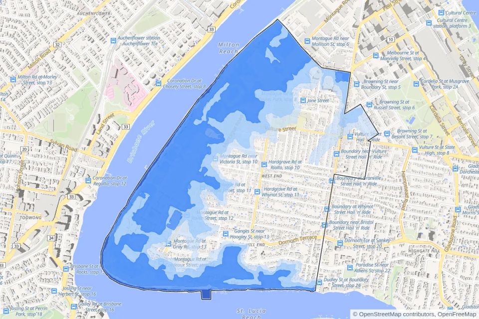
A free new online map shows 63% of West End falls inside Brisbane City Council’s flood mapping. That covers 1,441 lots and about 9,450 street addresses, mostly in the high and medium risk bands. Those bands shapewhat can be built: new homes usually need floors above the defined flood level, and filling can be limited.
Duncan Street, Victoria Street, Ferry Road and Mollison Street have the most addresses inside the flood overlay. Overland flow, a separate council map of stormwater running across land in heavy rain, touches another 19% of the suburb, and storm tide mapping reaches 3.5%.
The map also shows how the suburb is zoned under Brisbane City Plan 2014. A third of West End is character residential, and about 15% is high density residential, up to 8 or 15 storeys.
The West End page is free at https://zoned.com.au/qld/west-end-brisbane and there’s one for every Brisbane suburb.